
 |
I've been on high spirits recently after having a busy and exciting period observing comets followed by a G4 geomagnetic storm which turned the sky red for hours, to be honest with you I was still buzzing from this event, not only was it visually impressive and rare however it was also extremely photogenic so I was well pleased with nature's performance,I was happy with my images so the last thing I was expecting was another photo opportunity so soon. After what felt like an eternity of low pressure rain and mild air sourced from the far S/SW Atlantic the pattern suddenly changed, of course the models had been showing this change for a week but I paid it little heed that far out, but I watched with interest until closer to a more reliable time frame.
Cold Arctic air would be drawn down from the N and for several days we would be under a bitter Nly flow, this air mass was showery in nature and would also mean clean deep blue skies with frosts and even our first snow showers of the season. GFS showed snow showers on the 19th and 20th before temperatures slowly rose again however the cold would still remain for the rest of that week and weekend. Late November always seems to be a good time for our first early snow falls of the Winter season, the pattern produced snow around this time last year and here it was once again and I welcomed it with open arms. I studied the charts and planned on chasing on the 19th first, however my confidence in seeing much was very low, there was instability over the north Atlantic, but nothing remarkable, polar air over a warmer sea would generate convection then the strong Nly flow would blow showers inland where they would encounter colder air and hence turn to sleet and snow.
My own concern was the lack of instability (CAPE) inland which tends to mean weaker snow showers and hence less showers and less snow falling. GFS was only showing a scattering of wintry showers over the high ground of the N, far N. Sperrins, and more so for just inland from the N coast. The AROME was more bullish showing plenty of showers over the Sperrins, Mid-Ulster and even to the border, it turned out both would be correct, however snow would mainly be confined to the high ground. Owain Rice also noted the potential for isolated thunderstorms due to cells forming over the ocean and blowing inland, the tops were -20c and the cells were expected to be shallow/low topped however with steep lapse rates lightning was possible. Owain and I discussed this prospect the night before and he suggested the best place for sparks would be inland of coastal areas, mountains, and especially where wind turbines are located.
The night of the 18th/19th was spent radar watching, normally I would get up early the next morning and film the fresh snow on the mountains at dawn before any of the snow melted but I decided this would be a waste of time. Overnight showers were very light and scattered, they were falling as snow but I was certain there would be no covering worth talking about in the morning. My new plan was to get out chasing late morning onwards, models were showing an increase in snow showers during the second half of the day into the evening and the polar air would be digging deeper so my new goal was to capture snow curtains. For anyone who doesn't know these are the curtains/strands/lines of snow seen falling from Winter convection, they are one of my favourite scenes and they can be very dramatic and photogenic, some of them can be truly spectacular so I seek them out every cold season, so that was my plan. My expectations were still low however, I was skeptical of even getting any snow curtains, a good show is quite rare but I would take any samples so early in the season.
I woke up on the morning of the 19th, I was in no rush, then hit the road from 10.00 onwards expecting to be disappointed. My prediction had been correct, it was a complete let down. As I drove N I saw just a patch or two of a white dusting on Mullaghmore and Moneyneany, that wasn't good, these areas always get the first snow and do well, the snow landscape aerial plans were now a bust, but I had anticipated that anyway. With a heavy heart I drove to Glenshane, I could see the top from there and there was nothing, just patchy white, not worth taking the drone out for and to be honest not worth even looking at. The day was cold and sunny with a keen Nly wind, bitter, raw, but I was loving it, at least the skies were clear and crisp, very seasonal. So I sat there watching the sky for an hour and began to get frustrated, what a complete waste of time and diesel this was, there was no point hanging around, maybe tomorrow will produce something. I needed a mental lift, I was hungry so I called into the filling station and there in the hot food counter was 'festive fries' on display. I couldn't resist, how could I, it would be a shame not to, so I got a large portion, then indulged parked half way up the Glenshane. Turkey, ham, stuffing, gravy, chips, sausages, it was a real moment of self indulgence but it made me feel better and warmer, at least the trip wasn't in vane now.
I felt the sweet tooth begging for something so I turned this morning into a day dedicated to more self indulgence. I went to Maghera garden centre and had a lovely hot chocolate with marsh mallows, it's making me hungry now just typing this out. I sat in the cosey cafe thinking about how I could get something cool on camera this day, I only had two options, go home or wait around here all day for change. I decided I would work my way home and just keep an eye out as I went, but as I sat there I couldn't escape the sensation that something was going to happen. I saw a few weak showers to the N from the garden centre and in my mind's eye I had a gut feeling I was going to get a surprise when I returned to the van. I walked outside and there was nothing however the good feeling remained, so I made my way S back towards home. Between Desertmartin and Moneymore I could see a cell approaching behind me from the N visible in both wing mirrors, interesting, I could see white strands of snow falling from it and it was hinting at looking mean, yet it wasn't that cool so I kept driving. Instinct took over again so I decided to stop on the high ground outside Moneymore to check the sky for half an hour and that was when my day made a dramatic turn.
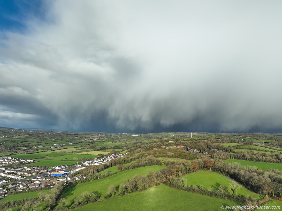 |
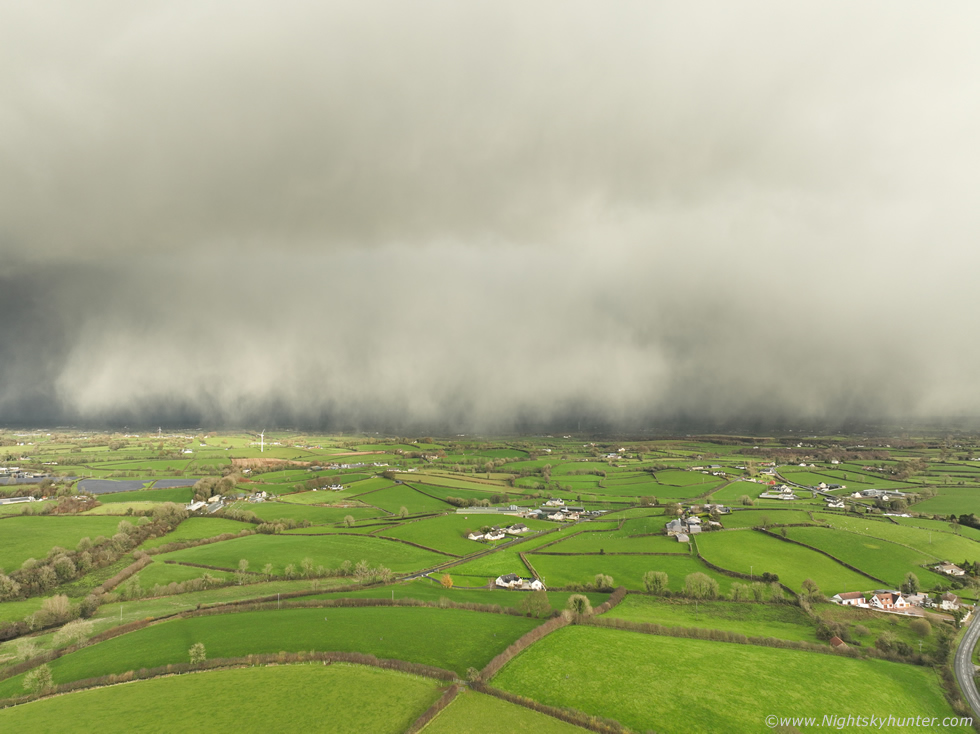
I could see something big and white approaching the area, it was the fuzzy anvil top of a large snow cell, trees blocked the full view so I sent the drone up half expecting to be disappointed and land again within 30 sec's. Once the drone cleared the top of the tree branches I saw this. I felt the sudden rush of adrenaline and excitement, what the heck, I just found what I had been looking for, snow curtains, and they were amazing. The entire N to NW sky was filled with them, changing shape seemingly by the second with falling strands, it looked like a mottled white wall approaching, and approaching fast!
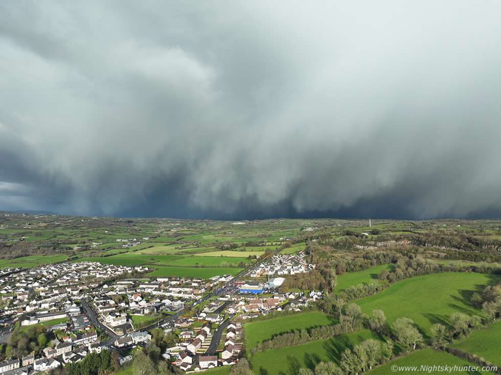 |
The rest of the time flying and using up this drone battery was like flying in a dream as I had no concept of time, I was so engrossed with this impressive unfolding scene. I recorded video sequences in 4K and stopped to take still images, constantly moving and changing angles. That's Moneymore below, about to be engulfed in it's first significant snow of the season.
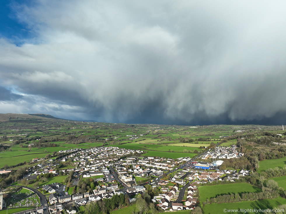 |
Those curtains were thick with snow, churning, falling, twisting, the sight was as mean as can be and I was loving it. The sky was clear all around and the sun was shinning lighting up the curtains and the countryside below, conditions were perfect. As the cell neared I could feel the temperature dropping fast and my hands began to freeze when the bitter cold outflow ahead of the cell arrived.
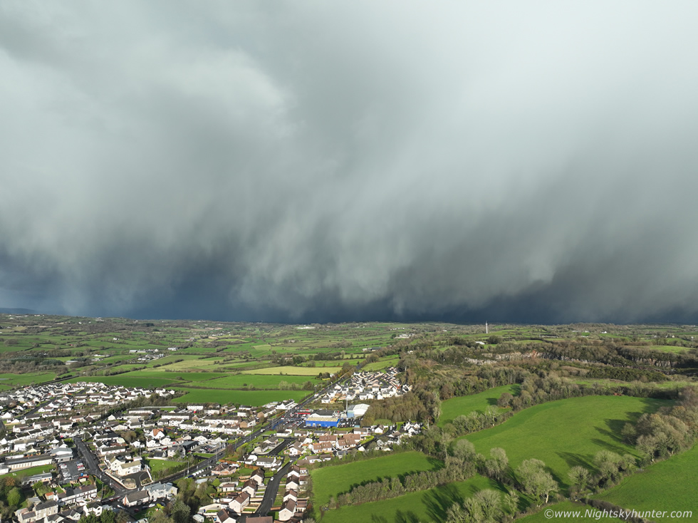 |
I've seen great snow curtains before however I was fairly sure these were the best I had ever seen, and that includes 2010 so that's a bold statement from me. All that snow was falling from a great height and looked like a thick wall of white and between the strands were areas of looming darkness and dark blue tones, Magherafelt would have been covered by it rite now.
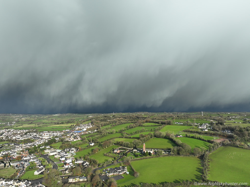 |
Panning to the right (NE), it was covering a big area of sky
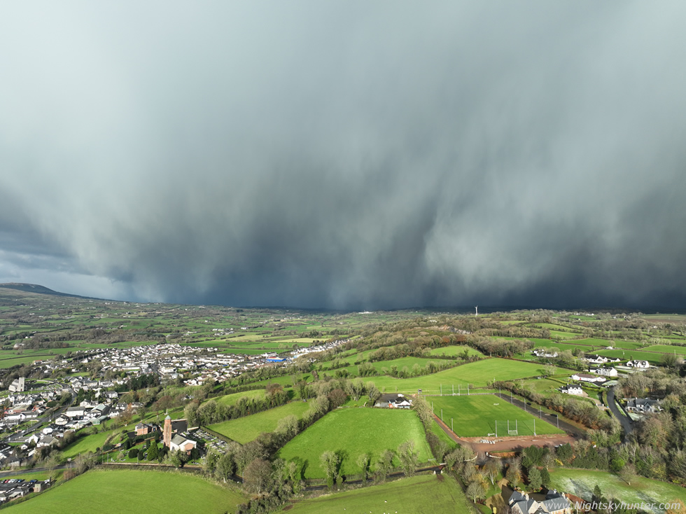 |
Back to the N with the slope of Slieve Gallion on the left, the white wall surged closer to Moneymore. This reminded me of an 'Haboob' seen in dusty parts of the world like Arizona when thunderstorm outflow scopes up desert dust and lofts it into a gust front of orange dust. This looked exactly like that only it was white and made of snow.
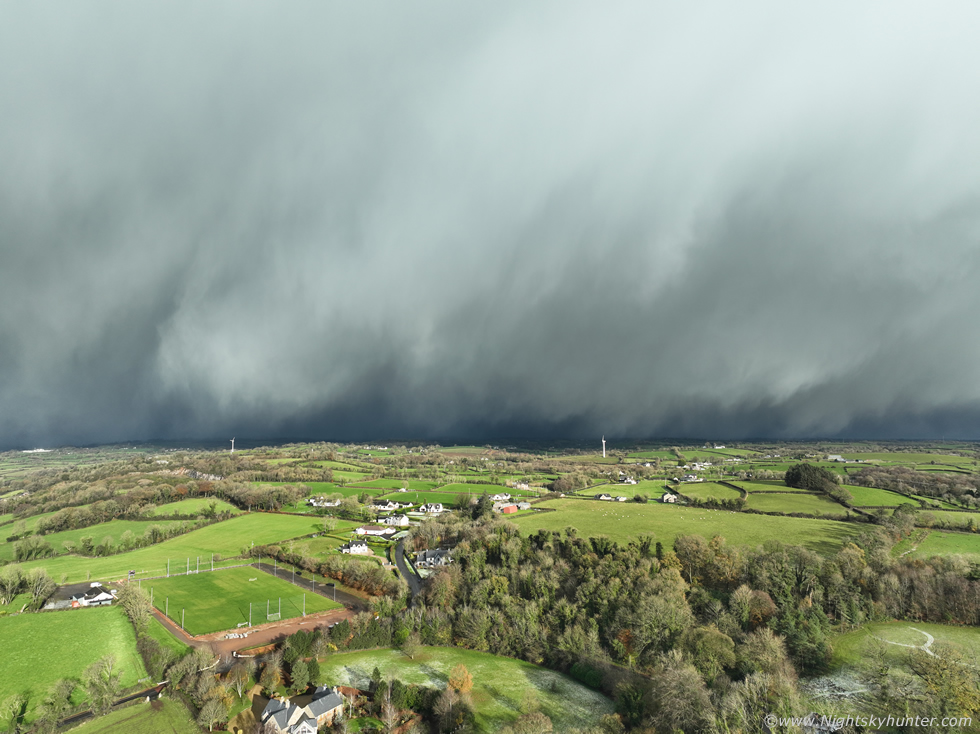 |
Just amazing, I was so captivated my situational awareness was affected because those snow curtains were alot closer than they looked here in the wide angle, they were blowing very fast my way however I didn't take note and kept filming.
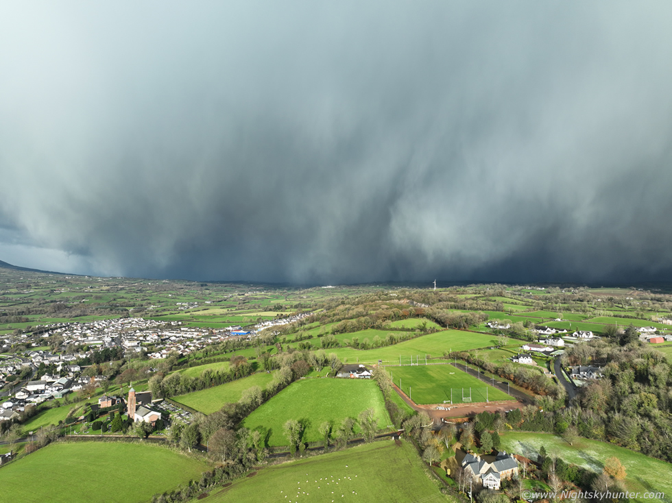 |
I absolutely love scenes like this, best snow curtains I've ever seen and on a day when I wasn't expecting to see much at all. What I liked about it was the contrast between cold white snow and the warmer green countryside, it captures a transition between Autumn and Winter in a single moment, a transient event, it was like nature had flicked a switch and suddenly here was Winter knocking on the door.
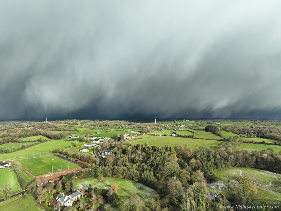 |
NE
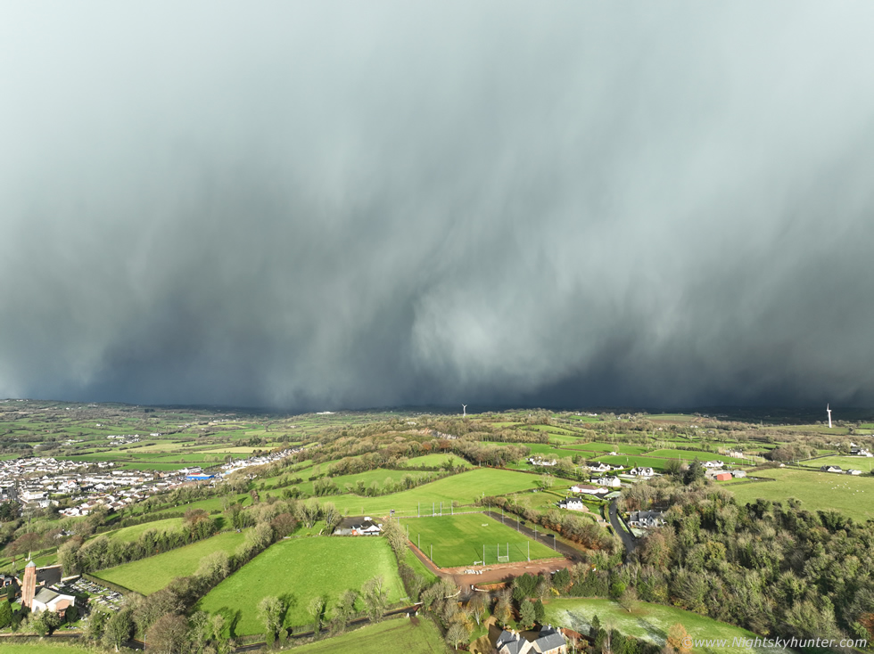 |
N
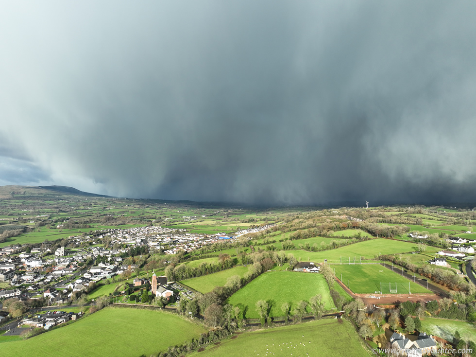 |
A raw cold wind cut through me, the trees were swaying, the drone controller was throwing up strong wind warnings, it was almost on me, I needed to think about flying back soon as I didn't want to get the drone caught out, I was only 300m away from the take off point and 120m high anyway, it wouldn't take long if I needed to react fast.
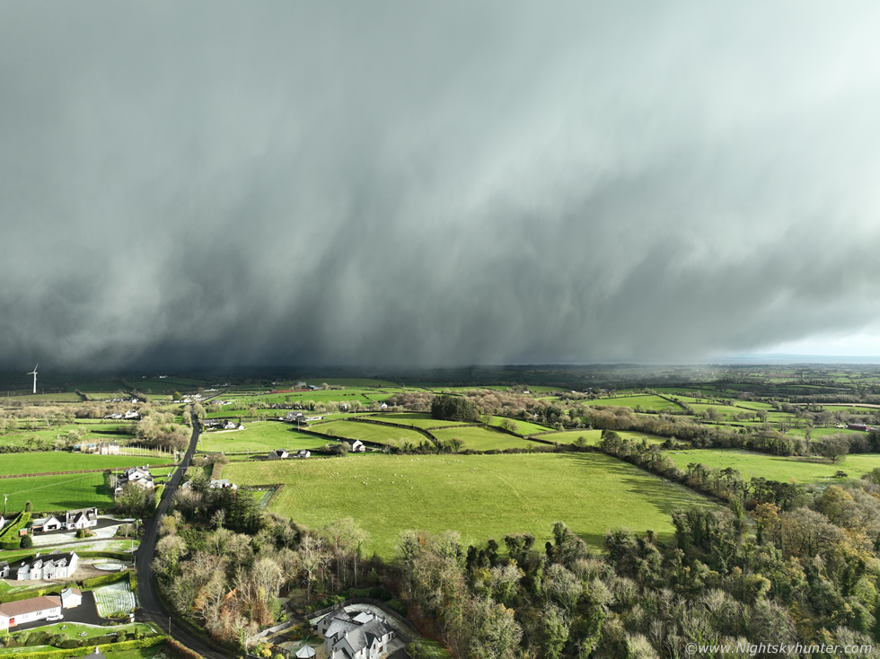 |
NE-E, I noticed on the controller screen just how fast the snow was blowing across the fields, it was shocking, then I realized it was too late, it was on the drone in an instant!, big white flakes filled the FOV of the camera, visibility dropped fast and more wind warnings, I turned around and flew back home with the camera down in sports mode. I was landing the drone as a heavy snow storm hit us hard turning the area dark. However I was buzzing and on a high, what a show!!!, truly epic snow curtains then getting slapped in the facing by blowing snow after it was just the icing on the Winter cake. I sat in the van and celebrated with a warm mug of tea from the flask watching the snow blowing sideways outside feeling rather happy and content with the whole thing.
 |
Eventually it passed through and that's when I appreciated how big this cell was, it trekked south producing snow the entire time across all of Tyrone then near Armagh and the border. Once it passed the sky was sunny and blue once again and there was barely a cloud in sight, if you had been in a shop and just walked outside you wouldn't have known anything special had happened. It wasn't until later when I got home that I learned from Owain Rice that this had been a thunderstorm, actually it was a thundersnow event, it had produced lightning when it was north of me, the charts recorded it as cloud to cloud lightning however it happened directly over wind turbines, it was these which likely generated the lightning within the cell, upwards lightning from the turbine into the snow curtains. So this was a thundersnow storm, I knew it had looked too mean and special to be a normal snow shower, what a start to the Winter season. Later I heard reports from others who had experienced it too who had expressed awe in witnessing the snow curtains. My mate Nigel McFarland had also captured it on drone during it's earlier phase from Glenshane area further N and it had an amazing core, just as good as any seen on a strong Summer thunderstorm. However this day wasn't over yet, another surprise was waiting to be captured.
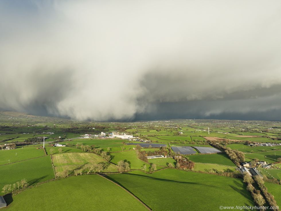 |
I went back home to Cookstown and got on with other things, meanwhile the sun shone and this time I kept the radar on to check the bigger picture. A few light snow showers were drifting down from the far N. One hour later the radar indicated a large shower well to the N of me but moving S, I went outside to take a look, I could only see the white tops but it was big so I sent the drone up for a look. Second surprise of the day, the cell looked substantial and solid in places, what immediately got my attention was what looked like a snow downburst descending to the surface, yet again this was along the E side of Slieve Gallion and near Moneymore just like the last event. The structure to the right was curious, a long solid base and behind it was either another base or long line of snow, the entire view looked a little like a HP supercell base with inflow bands. I'm not saying it is, I'm just having fun with this but the low level structure was cool, however it was the curtains to the left which completely stole the show.
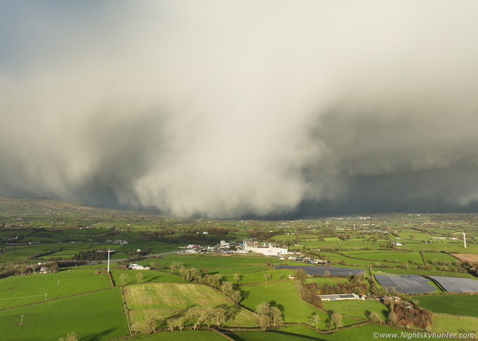 |
The snow curtains almost looked like they where slightly wrapping around the W flank of the main feature, I jokingly thought this looked like a snow tornado, how cool looking.
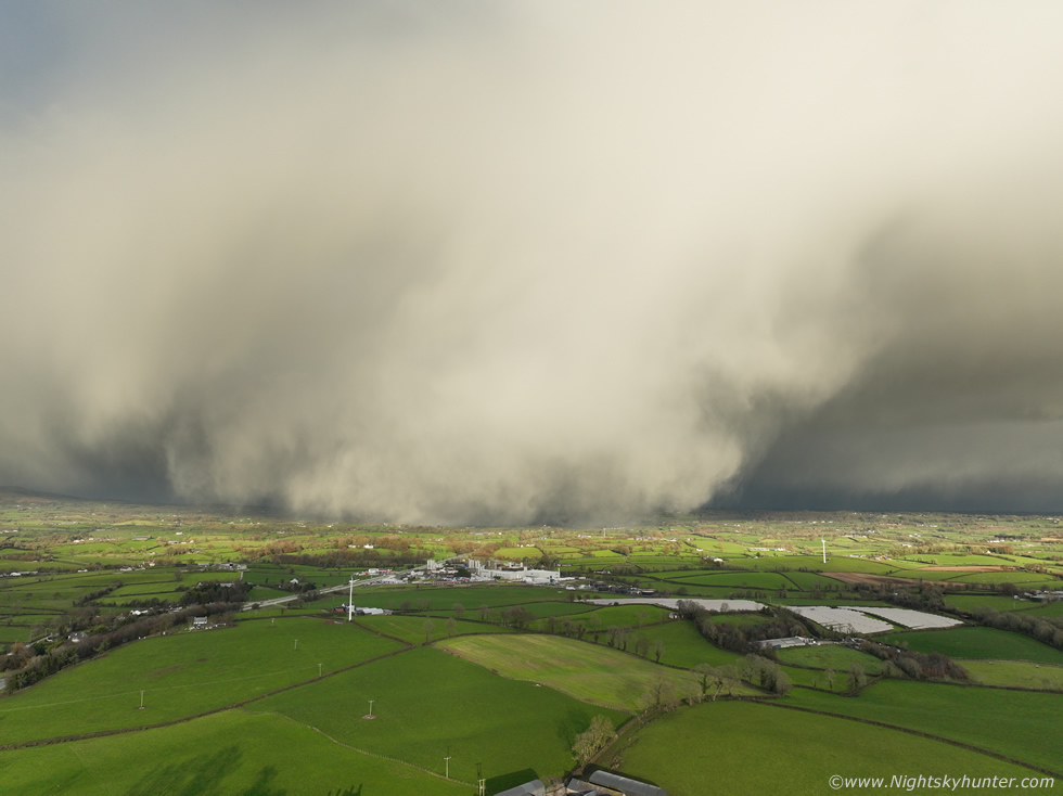 |
Honestly this looked like the El Reno wedge tornado made from snow, yet again top tier Winter structure on full display, if I saw this during the Summer time I would be thinking a significant event was happening. In the foreground is the Dale Farm factory and solar panel array nearby. I have never observed a feature like this from snow before, what amazed me was how could this be happening from such a timid early season polar flow, I haven't seen forms like this before during any of the severe snow events during prime Winter.
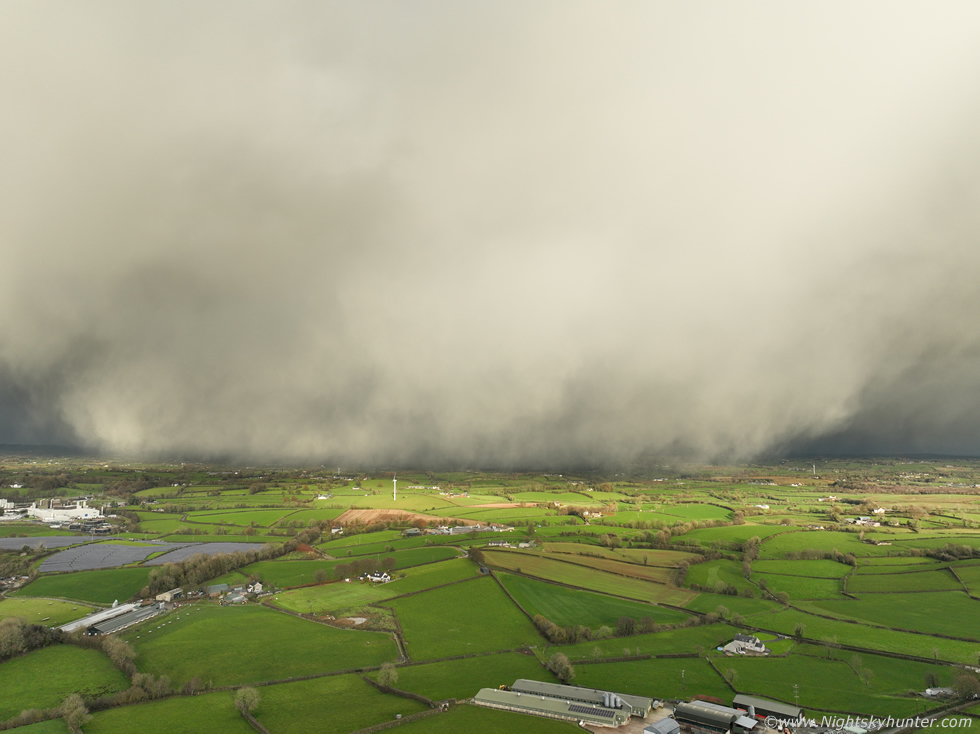 |
The 'wedge' now filling the wide angle FOV, moving to the right and getting closer to Cookstown. There's a cool moment I got on video at this time, I was flying the drone sideways to the right at full speed in P mode keeping track of the snow curtains, they were also blowing to the right at high speed and for a minute or so the drone was matching the speed of the curtains, both in synch, it just showed how fast this snow was blowing.
 |
W side of the cell with huge curtains now obscuring Slieve Gallion, I don't know why I never thought to do a 180 degree pano, it completely escaped my mind at the time. I did get plenty of video however which you can view on youtube at the end of this report.
 |
Wall of snow inbound, almost like a ground-scrapping shelf, this time I didn't make the mistake as before and brought the drone back just in time, the snow arrived as the drone landed. I went inside and watched the snow blowing hard across the area. What a day this had turned out to be for photo opportunities, nature produced scenes far beyond my expectations, this just goes to show that a chaser should always be on alert during all set-ups.
I've seen other great snow curtains, 2009 and 2010 were amazing, but this day beats those. Here are other examples for comparison...
1) Glenshane Pass morning snow curtains January 2028...
http://www.nightskyhunter.com/Glenshane%20Blizzard%20&%20Birren%20Rd%20Truck%20Jack%20Knife%20-%20Jan%202018.html
2) Garvagh snow cell with curtains January 17th 2024, this was also brilliant to watch in person...
3) February 2022 Benbradagh...
http://www.nightskyhunter.com/Storms%20Eunice%20&%20Franklin%20-%20Feb%202022.html
4) How can I forget December 27th 2027 at Benone Beach after sunrise...
http://www.nightskyhunter.com/Benone%20Beach%20Winter%20Convection%20-%20Dec%2027th%202017.html
With the cold spell off to a great start I was looking forward to the next day, November 19th, this looked to be much better than expected. Regular snow showers were forecast overnight with yellow warnings for snow and ice with some sources giving 5cm on high ground which isn't too bad for early season. I watched the radar overnight intently and was amazed to see non stop snow showers coming down on a N-S axis constantly all night long, the situation was almost like lake effect snow seen on the great lakes of North America and Canada. Looking out the windows I saw regular snow falling, big heavy flakes, we have the Christmas trees up early and the sight of the snow falling outside against the foreground of the tree lights couldn't have been more festive. I knew the next morning would result in a decent snowfall, this would be my chance of getting aerial Winter landscape scenes. Based on radar my usual spots looked promising, the Sperrins up to Glenshane however the southern Sperrins looked to be getting more snow showers on radar than anywhere else.
 |
I was up early the next morning, there was a layer of snow in Cookstown and 2" of snow on the van windscreen, that was a good start, the mountains were bound to be good. Rhua and I drove off at first light at a strategic time when the sun had already risen enough for decent natural light. I knew where I wanted to go, I went straight to the Moneyneany-Birren-Mullaghmore area. When I got a visual on the hills I knew everything had worked out perfectly, they looked beautiful as always and there was bright sunshine on the fresh snow surrounded by clean blue skies, perfect for photography. I wasted no time and got the drone up for a flight over Eagle's Rock.
 |
Past Eagle's Rock facing the summit of Mullaghmore which was looking gorgeous
 |
I spent the entire morning watching the skies, flying, sipping warm mugs of tea and enjoying the Winter beauty of the landscape. Despite a mostly dry day forecasted there where a few random snow showers passing over the hills which complimented the landscape. This is the south side of Eagle's Rock, snow shower blowing left to right.
 |
Another snow shower passing over Moneyneany, a nice contrasty scene.
 |
More light snow showers, I love capturing these over the mountains
 |
I took a drive up the Birren road, a notorious spot, I didn't go all the way up as it got too slippery. Drone view facing along the road, if you follow that route it will eventually take you to the main Glenshane Pass outside Dungiven. Rhua had a good time playing in the snow with her antlers on.
 |
Colleen Webb was in the area so we met at Moneyneany for a catch up and more filming. As we chatted a large cell came into view which began dropping widespread snow curtains, I couldn't resist, drone back in the air yet again, it wasn't heading for us as it was more on a left to right path however it looked stunning over the snowy Sperrins.
 |
Above and below are stills from the 4K video using the camera's digital zoom to get in closer. Such a cool sight if you will excuse the pun
 |
x2.8 digital zoom, I would love to have been closer to that one, I'm fairly sure that lake within the forest is Banagher Dam
 |
Final image with the wide angle, big snow shower in pristine blue skies, it really doesn't get much more beautiful than that. This might have been my personal favourite scene of the day.
 |
Final scene of the day when a close snow shower brushed past us, I lost count of the amount of times I had the drone in the air, it must have been six flights, all the batteries were charged at least twice using the portable power unit.
 |
By 13.00 there was a slight thaw on lower ground and roads were back to their usual black and wet look, however the mountains still held onto their snow blanket. We decided to call it a day, we had seen the best of what nature had to offer and were more than happy with our images and footage. I have to say I was really impressed with the scenes over the last 48 hours, photo opportunities which I never expected to see given the synoptics. It's worth watching all the videos below to get some idea of what it was like to be there in person.
November 19th snow curtains approaching Moneymore and the best I've ever seen
November 19th second snow curtain event approaching Cookstown with the snow 'wedge'
November 20th drone footage from Birren Rd, Eagle's Rock, and beautiful snow showers with vlog segments. I would like to thank you all if you have made it this far. The models are currently showing a return to warm Sly weather with Atlantic-driven fronts so this might be the only snow event before Christmas, or will it?, we are currently hoping to see a return to cold weather mid to late December, let's see what happens.
Martin McKenna